
Tracing a Mahoning County Street Directory
Mahoning County records have to be read in order. The Auditor starts with an address and returns parcels, not a household list. Its card can identify the property, the recorded owner, tax information, a legal description, and sale context. That card produces the facts needed for a document search. A voter result is a different, individual verification tool and must not be turned into a block roster. A historic street directory adds an older householder entry for its own publication year. Keeping those roles separate makes a street-by-street result far more reliable.
- Enter the address in the Mahoning County Auditor Property Search. Save the parcel number, situs address, owner, acquisition clue, and legal description.
- Open the parcel in the County GIS map, then use its boundary and identifying details to make sure nearby results belong to the same street segment.
- Use the owner and legal-description clues in the Recorder index to locate the recorded deed. Follow the earlier grantor or the same legal description one transfer at a time.
- When a specific person needs registration confirmation, use the official Ohio voter tool with that person’s name and county. It is not a street browse feature.
- For a past household, locate the address in the correct historic street or householder directory, record its edition and page, and compare it with the alphabetical entry.
Each link has a date and purpose. An owner can use a different tax mailing address, a directory can be historical, and a voter result can be protected or absent. Do not force them into a claim that the records do not support.
Mahoning County Street Searches at the Auditor
The Auditor’s published instructions make whole-street work possible without guessing at a parcel format. For one property, use House # and Street Name. For a range, add House Number High. For a whole street, leave both number fields empty, enter the street name, and omit words such as Street, Drive, or Lane. The same search area accepts a partial owner name or full parcel number. Results can be paged, and advanced searches can export a CSV, but the output remains assessment and parcel data rather than a resident list.
| Auditor field | Use on a street search | Format or limit |
|---|---|---|
| Owner Name (Last First) | Find a recorded owner after a parcel clue | Optional; partial last name and several last-first forms are allowed. |
| Parcel Number | Return to one known parcel | Optional; retain leading zeroes, with dashes or dots accepted by the guide. |
| House # | Find one address | Optional; pair with street fields. |
| House Number High | Search an address range | Optional; use with House # and Street Name. |
| Direction (Abbv) | Separate directional forms of a road | Optional address component. |
| Street Name | Find an address, range, or full street | Required for address searching; omit the street-type word in the published method. |
| Street Type (Abbv) | Refine an address form | Optional suffix component. |
| Township, municipal, school, or neighborhood fields | Narrow advanced results | Optional live selections; check current choices before relying on them. |
The Auditor reports 163,344 parcels across 425 square miles. That scale explains why a street directory search benefits from the address fields rather than a broad owner-name query. Current values are identified with a tax-year context, so a recent sale should still be checked against its recorded instrument.
Note: A result on a parcel card is evidence about the parcel and recorded ownership context, not a current roll of everyone at that address.
Mahoning County Street Record Address Types
Three address fields on a property card can look alike while meaning different things. The parcel’s situs is its physical location. The Deeded Owner Address comes from the last recorded ownership document. The Tax Payer Address is where correspondence is sent. A mailing address may be outside the county or state. None of those fields establishes that a named person currently occupies the property. This distinction is central to any address-based street directory work.
- Parcel
- A unit of property assigned an identifier for county assessment and mapping.
- Situs address
- The physical location used for the parcel, distinct from a mailing address.
- Plat
- A recorded subdivision or map document that can connect a lot and block to a street address.
- Criss-cross directory
- A historic volume arranged by address or street, rather than only by a person’s name.
The parcel card also gives valuation, legal description, improvements, sales, taxes, and links to GIS. The legal description is especially useful because it can bridge a street number that changed, a subdivision lot, and a recorded document. Treat the card as an index to the next source, not as a final title opinion.
Mahoning County Streets Through GIS Identify
The Mahoning County GIS and Tax Map is the spatial part of the street directory trail. It can locate an address, parcel ID, place name, or keyword. The viewer also documents layers for parcel boundaries, roads, districts, neighborhoods, subdivisions, addresses, assessment information, and structures. After locating a street segment, use Identify to open a parcel and follow the tax-information link back to the Auditor. Its tools include buffer, measure, mailing-list, print, report, share, and export functions, but its data is informational and is not a legal survey.
The County’s GIS Map Viewer help illustrates the interface and its documented tools.
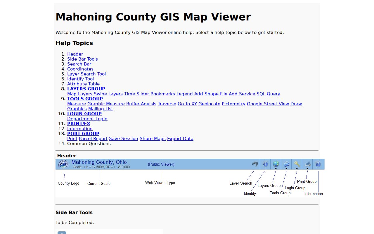
Use the viewer to compare parcel geometry and map layers, then confirm recorded details with the Auditor or Recorder rather than treating the map as a boundary survey.
Mahoning County Street Deeds Need Party Clues
An address alone will not open the Recorder’s anonymous AVA search. Its enabled criteria are Party, Date Range, Document Number, Document Type, Book/Page, Reference Number, Subdivision, and Subdivision Lot/Block. Address and Parcel are disabled, and anonymous document-image viewing is disabled. That is why the street directory sequence starts with the Auditor and GIS. Bring the parcel card’s owner, acquisition date, and legal description to the Recorder search, then match the deed’s parties and description before moving to the earlier transfer.
The official Recorder AVA document search shows the local document-search route.
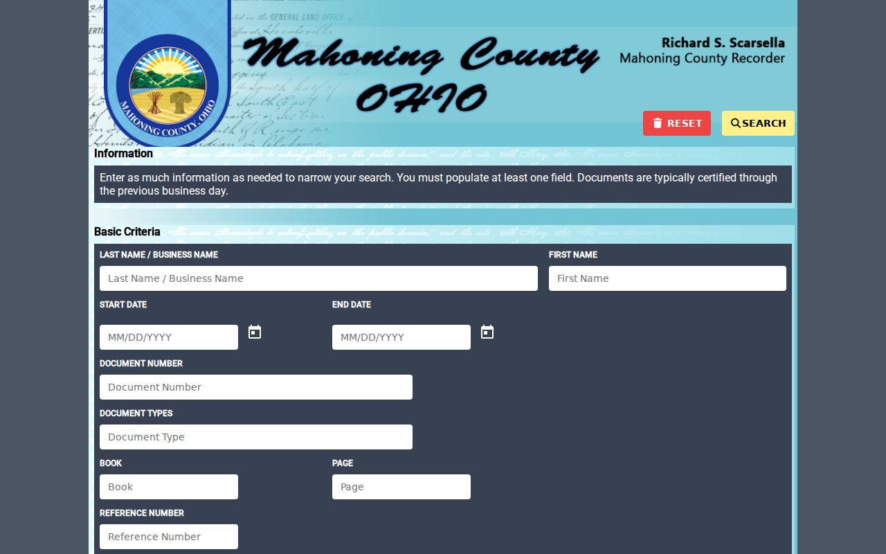
AVA lists deed, plat, survey, mortgage, and subdivision-related document types. Record the party spelling, recording date, document or book/page reference, and legal description for each confirmed link.
Mahoning County Street Records by Address
No single source answers every question about a road. The record layers below use different keys and have different limits. Matching a parcel, legal description, and document details is stronger than relying on the same surname or a single mailing address.
| Address-record layer | Key for use | What it can establish | Limit to retain |
|---|---|---|---|
| Auditor parcel record | Street, owner, or parcel | Parcel identity, assessment and sale context, deeded and tax mailing cues | Not a household or current-residence list |
| GIS / Tax Map | Address, parcel, or map selection | Geometry, adjoining parcels, roads, districts, and related panels | Not a legal survey or title conclusion |
| Recorder AVA / Laredo | Party, date, document, book/page, or subdivision | Recorded document and legal-description trail | No anonymous street or parcel field |
| Permit Inquiry Manager | Address, owner, parcel, permit, or application | Dated construction, inspection, and maintenance activity | Activity does not prove residency |
| Historic criss-cross directory | Address in one edition | Householder or contact context for that publication year | Not evidence of modern occupants |
The public County property-boundaries GIS layer is a useful view of the parcel data behind the map.
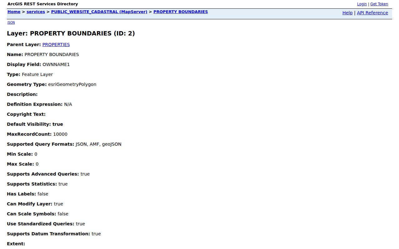
The layer helps verify which parcels meet along a street. It does not settle a property line, ownership dispute, or current household question.
Mahoning County Street Permits Date Property Work
The official Permit Inquiry Manager adds a useful date layer to a street search. Permit Information accepts permit number and type, application number, house number, street name, lot number, owner name, parcel ID, and project. Lot/Address and Address Information also accept address, owner, and parcel clues. Permit types include Building, Certificate of Occupancy, Demolition, Mechanical, and Property Maintenance, with nightly refresh stated at 3 a.m.
Use a permit to document work, demolition, an inspection, or a certificate. It is not proof that an applicant, contractor, owner, or named occupant lived at the location. Youngstown zoning may also be involved, while County Building Inspection serves other county districts. A focused request to the responsible custodian is the fallback if the web result is incomplete.
Mahoning County Street Directory in Historic Volumes
For an older address, the local historic route is the street or householder section in a directory, not a modern parcel screen. The Mahoning Valley Historical Society reports Youngstown directory volumes for 1869, 1872, 1875/76, and 1877 to the present, with some editions extending to nearby communities. The 1949-50 Burch directory specifically advertises a street and householders directory with telephone context. Record the edition, exact address form, spelling, and page before treating the entry as a past-household lead.
The alphabetical side of a volume may add an occupation, office, boarding clue, or widow notation. Those entries are historical and edition-specific. The longer collections and how to read them belong on the Mahoning County city directories page, rather than being folded into a current address result.
Note: A historic directory can show a householder in its publication period, while a Recorder document and a parcel card answer separate ownership questions.
Mahoning County Street Numbers Need Context
Youngstown’s address numbering follows more than one origin. East-west streets crossing Market Street or Wick Avenue number outward from those intersections. North-south streets between Fifth and Himrod use Federal Street, while others use Mahoning and Himrod or the end leading from Central Square. Elsewhere in the county, municipal rules and former township boundaries can change the address context. A directional abbreviation, road type, plat, and legal description deserve attention when an old number does not fit a current map.
The Recorder AVA catalog includes a YOUNGSTOWN RENUM INDEX BOOK document type. Preserve the historic address form, use that category where applicable, then test the match with plats, deeds, historic tax maps, and the lot or block. No source established a single countywide renumbering year, so a clean conversion should never be assumed.
Mahoning County Street Directory Access Gaps
Online records do not make the counter route obsolete. The Recorder describes Laredo Anywhere as 1980 to present, while another Recorder statement describes electronic index access from January 1985. Use the stricter 1985 point for an online plan and acknowledge the discrepancy. The Recorder has thirteen public computers for older material and states that staff cannot search a record for a requester. County Records Management has microfilmed millions of 1800s-onward county records, including deeds, mortgages, tax material, and Common Pleas files.
The Auditor and GIS offices provide in-person access as well. For an existing nonexempt record not available on screen, Ohio’s Public Records Act, ORC 149.43 supports a focused request to the office that maintains it. Give the address, date range, record class, and desired delivery form. The law provides access to existing records, not a request for a newly created street roster.
Mahoning County Street Directory Privacy Limits
A parcel card does not disclose every resident of a home. Household membership, utility-customer details, delivery data, protected voter records, and DMV personal information are not street-directory material. Ohio voter data is subject to ORC 3503.13 exclusions, and Safe at Home participants have confidential registration under ORC 111.44. An empty or partial result can reflect privacy, jurisdiction, spelling, timing, or a record that was never digitized. It is not a reason to search around a protection.
Lawful personal use. Use Mahoning County street records for legitimate personal, property, family-history, and civic questions. Do not use an address trail to monitor, threaten, stalk, harass, or intimidate anyone.
When a street result needs verification, compare the actual custodian record, date, and address role. For an urgent safety concern, contact emergency services instead of relying on an online record.